Stay informed and safe with Zoom Earth, the ultimate interactive weather map and real-time hurricane tracker. This powerful tool offers a suite of features designed to keep you one step ahead of nature's most formidable forces, including hurricanes, typhoons, and tropical cyclones.
With Zoom Earth, you can access near real-time satellite imagery sourced from top agencies like NOAA GOES, JMA Himawari, EUMETSAT Meteosat, and NASA's Aqua and Terra satellites. This comprehensive coverage ensures you have the latest visual data at your fingertips, crucial for tracking the progression of tropical storms.
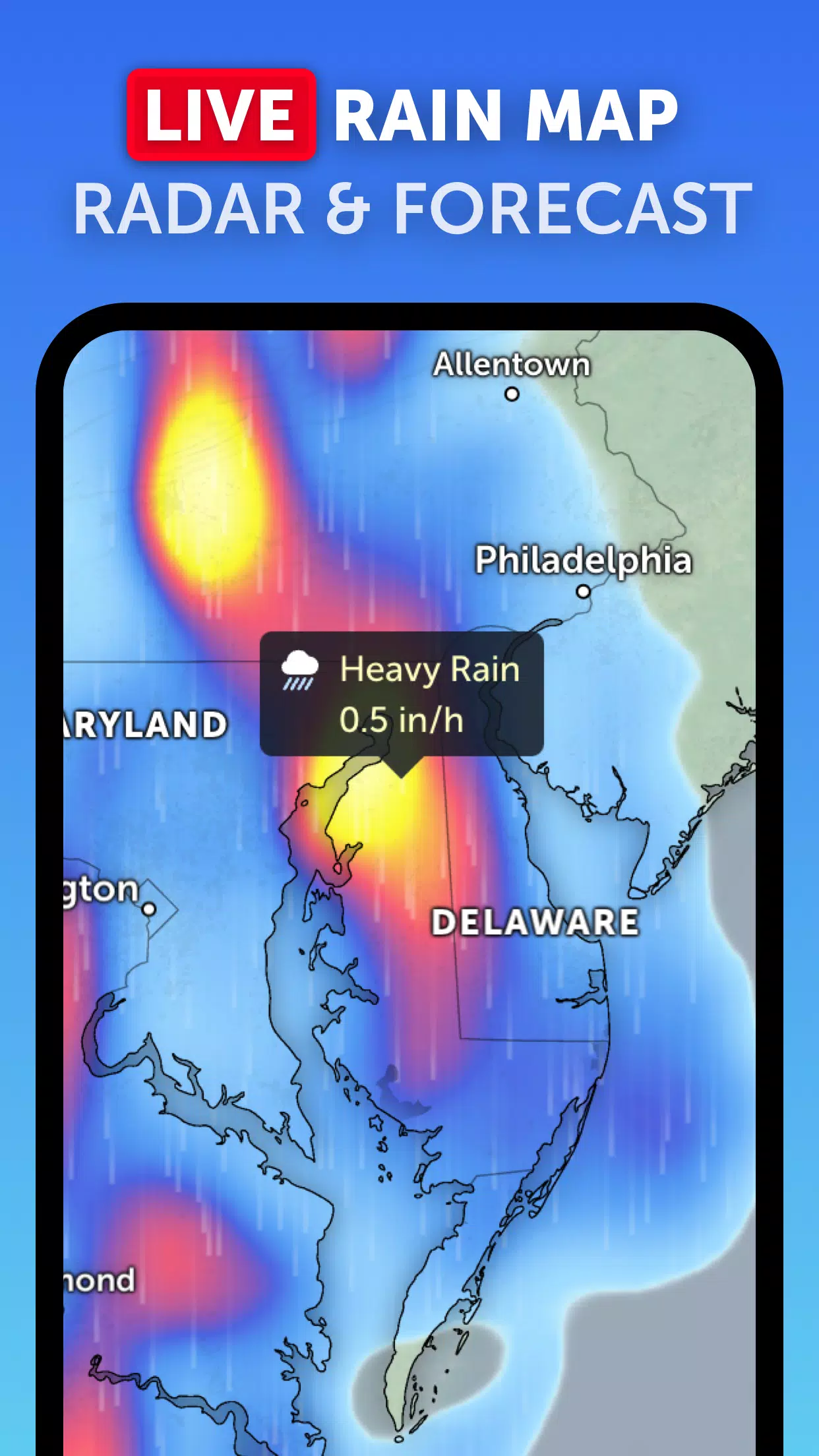
Stay ahead of the storm with our real-time rain radar map, which uses ground-based doppler radar to show current rain and snow patterns. This feature is invaluable for anticipating the impact of hurricanes on your local area.
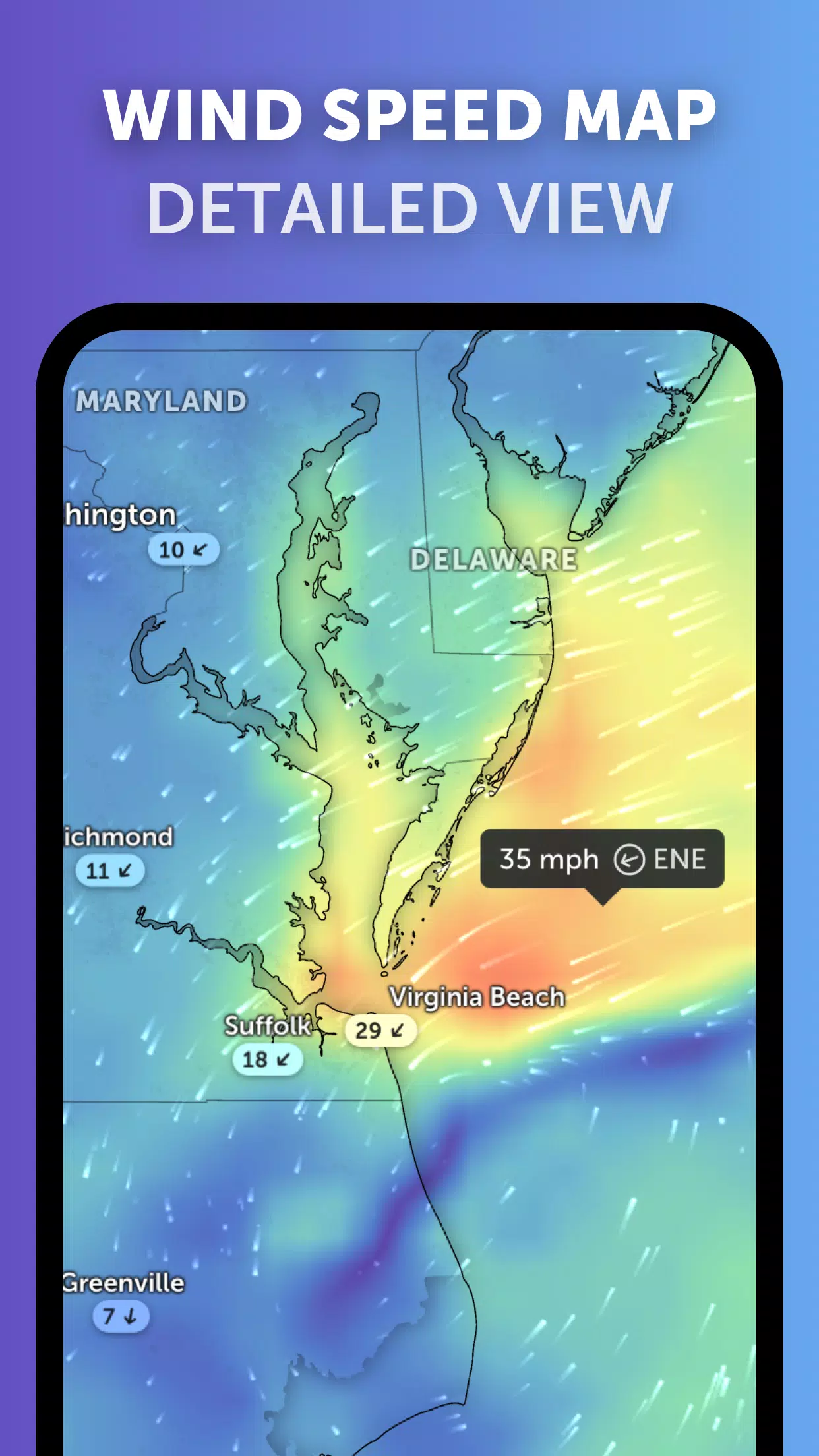
Explore our stunning global forecast maps for a detailed look at the weather ahead. These interactive visualizations provide forecasts on precipitation, wind speed and gusts, temperature, "feels like" temperature, relative humidity, dew point, and atmospheric pressure, helping you prepare for any incoming tropical cyclone.
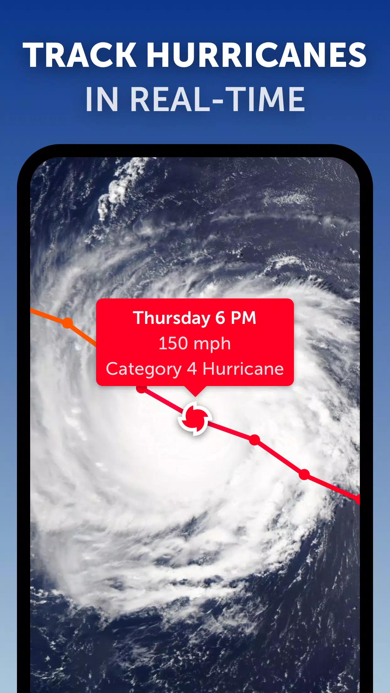
Zoom Earth's hurricane tracking system is second to none, allowing you to monitor hurricanes from their inception to their peak intensity, using the latest data from the National Hurricane Center (NHC), Joint Typhoon Warning Center (JTWC), Naval Research Laboratory (NRL), and the International Best Track Archive for Climate Stewardship (IBTrACS).
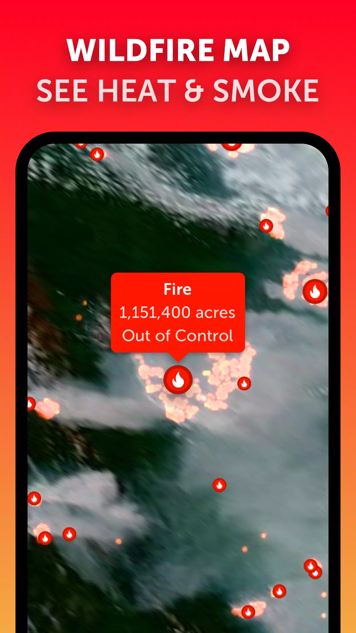
In addition to hurricanes, Zoom Earth also provides wildfire tracking. Our active fires and heat spots overlay, updated daily with data from NASA's Fire Information for Resource Management System (FIRMS), helps you monitor wildfires that could be exacerbated by tropical cyclones.
Customize your experience with Zoom Earth by adjusting temperature units, wind units, time zone, animation styles, and more through our comprehensive settings. This ensures you get the weather information you need, tailored to your preferences.
What's New in the Latest Version 3.1
Last updated on Sep 19, 2024
- Reduced clutter when viewing multiple tropical systems, making it easier to track multiple hurricanes simultaneously.
- Separate alerts for Atlantic and Eastern Pacific systems, enhancing your ability to stay informed about specific regions.
- Improvements to map labels for clearer and more precise information display.
With Zoom Earth, tracking hurricanes, typhoons, and tropical cyclones has never been more accessible or informative. Stay safe and prepared with our real-time data and detailed forecasts.
Tags : Weather